Tropical system near Cuba could mean rain for a parched Texas
- Submitted by: manso
- Society
- 07 / 27 / 2011
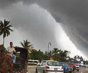
July 27, 2011Posted: 07:25 AM ET. The stubborn ridge of high pressure over the middle of the Lower 48 hasn’t moved much in the last three weeks, and today is no different. That means the ridge will still crank out the heat over the Mid Mississippi Valley and parts of the Midwest. I’ll show you the temperatures, but it's safe to say Dallas will reach 102 today (at DFW) making it the 26th consecutive day of 100 or better. There may be some relief for the Lone Star State, though, with a developing tropical system near Cuba.
There is a good chance this will turn into at least a tropical depression, and maybe a tropical storm. All the tracking models take this thing into Northern Mexico or Texas by late Friday or over the weekend. I expect it to bring good rain and cooler temperatures to Eastern/Central Texas... I just hope it doesn’t blow up into a full-blown hurricane. I’ll keep you posted.
Storms are aligning themselves now in the Upper Midwest, and this trend will continue throughout the day. Severe storms are possible over the Wisconsin, Iowa, and Nebraska area today as the frontal boundary slides eastward. but it'll be drier in the Northeast after the tough round of storms yesterday. Look for more rain along the Gulf Coast, too.
The West looks similar to yesterday, with monsoonal Four Corners showers and some clouds hugging the coast this morning. More on the program.
*Follow "Morning Express with Robin Meade" meteorologist Bob Van Dillen on Twitter: @BobVanDillen
Posted by: Meteorologist Bob Van Dillen
Filed under: Heat • Rain • Severe Weather • Storms • Tropical Depression • tropical storm • Weather
Source: http://mxp.blogs.cnn.com/2011/07/27/tropical-system-near-cuba-could-mean...
Comments