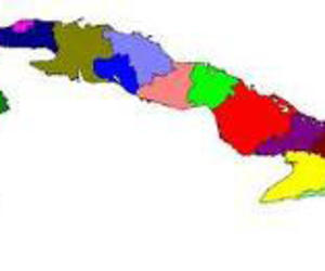
Cuba its provinces and municipalities over time
- Submitted by: manso
- Editorial Articles
- 01 / 14 / 2011
Alberto Núñez Betancourt. BY way of a royal decree issued on October 8, 1607 by King Phillip III, Cuba was divided into "two halves," each with its own independent government, La Habana and Santiago de Cuba, with the title of Captain General reserved for the governor of Havana. Up until that time, the island had been considered a single province.
This act is recorded in history as the first territorial division implemented by the colonial powers. It was not, however, until 1774 that a political-administrative division was justified, as a consequence of changing demographics with the population reaching 171,620 residents, according to the first census conducted in the country, as well as significant development based on the plantation economy and the evolution of the sugar industry.
The division created just two departments: Oriental or Santiago de Cuba, with its seat in this city, including the territory which now comprises the country's five eastern provinces and Occidental or La Habana, from the current province of Pinar del Río to Camagüey, and including the Isle of Pines, with its seat in San Cristóbal de La Habana, the capital beginning to flower.
The historic evolution of the country's political-administrative division reflects a close relationship to its demographics; as the population grew, the territorial structures had to be adjusted, according to architect Fausto Martínez García, Physical Planning Institute (IPP) specialist.
Two more divisions took place during the 19th century. In 1827 the departments were divided into three: Oriental maintained basically the same boundaries, while Occidental included the territory between what are today Pinar del Río and Matanzas, plus the Isle of Pines.
Central was the name given the new department and it included the current provinces of Camagüey, Ciego de Avila, Sancti Spíritus, Villa Clara, Cienfuegos, and part of Las Tunas.
An interesting fact noted by Martínez García is that the capital of the new province was not Santa Clara, the city which, decades later, gave its name to the province located in the center of the island.
Trinidad was named department capital of Central because it was, at that time, an important population center and the sugar industry, led by Valle de los Ingenios, was developing notably, according to the IPP specialist.
By the middle of the century, Cuba's population had exceeded the one million mark. The use of the word 'province' appeared for the first time in 1878, when, through a June 9 royal decree, the designated areas were established towards this end.
Researchers affirm that the colonial power was motivated by political reasons to divide the island in six sections. Once the Ten Years’ War ended and the Baraguá Protest had taken place, the Spanish government felt the need to offer (never fulfilled) concessions to the Cuban insurrectionists, among them representation within the Spanish courts. The division of the country into provinces allowed for the election of deputies from each of these.
Santiago de Cuba, Puerto Príncipe, Santa Clara, Matanzas, La Habana and Pinar del Río, with capitals in the cities of the same names, were established. The Isle of Pines was assigned to the province of La Habana.
The 20th century: the population grows, as does the number of provinces
The increasing birth rate and European immigration to the country after World War II brought the population to 5.8 million-plus by 1953, the year during which another political-administrative division took place.
This time, for some provinces, the territorial boundaries remained essentially the same, but names were changed. Santa Clara became Las Villas; Puerto Príncipe, Camagüey; while Santiago de Cuba was named Oriente.
The triumph of the Revolution brought the challenge of a reorganization which would support the development of a socialist society. It was clear that this was not going to be implemented within a short period of time. A broad range of studies were necessary to adequately support the decision making process.
A first division, in 1970, maintained the six provinces with the names established in 1953, but adjusted the boundaries of some. La Habana took from Pinar del Río the municipalities of Mariel, Artemisa and Guanajay; Las Villas ceded Ciénaga de Zapata to Matanzas; and Oriente was assigned the municipalities of Amancio Rodríguez and Colombia, which had been in Camagüey, Martínez García explained.
As a significant step in the institutionalization of the country, after 15 years of accumulated experience, the Cuban Revolution undertook the renovation of legislation inherited from the colonial era. The Communist Party of Cuba and the revolutionary government considered feasible the creation of new Popular Power bodies. One of the articles of the May 3,
1974 Law 1269 establishes, "the election of Popular Power bodies, so that the masses are institutionally incorporated in state and administrative decision-making and so that the people are directly included within state bodies, this being fully identified as a socialist state of the workers, fundamentally democratic…"
A resolution from the 1st Congress of the Communist Party of Cuba, in December of 1975, called for a new political-administrative division of the country, with the goal of achieving a more direct link between the national leadership and the base, given the demands of the country's planned economic and social development.
The following year, the number of provinces was increased to 14 and the Isle of Pines was designated a special municipality, formally re-named the Isle of Youth in 1978. This area was administered directly by national level bodies.
This division led to the former province of Oriente being divided into five: Guantánamo, Santiago de Cuba, Granma, Holguín and Las Tunas. Camagüey ceded part of its territory to the new province of Ciego de Avila. The province of Las Villas became Villa Clara, its territory reduced with the creation of Cienfuegos and Sancti Spíritus.
The province of La Habana was divided in two: City of Havana where the capital of the country is located and the vast province of La Habana (19 municipalities), uniquely without its own provincial capital.
Current modifications
The new political-administrative division, which came into effect in early January of this year, is meant to provide a more rational organization facilitating the delivery of services to the population and better government functioning in the performance of its tasks.
Another essential goal is the elimination of overstaffing and multiple offices, with the placement of political and mass organizations, as well as Popular Power bodies, within the same building. One clear indication of efficiency is the fact that the number of leadership staff approved for the various levels and institutions within the new provinces Artemisa and Mayabeque is approximately 50% of the number employed within the former province of La Habana.
The modifications implemented in the western provinces (Pinar del Río, Artemisa and Mayabeque) are consistent in terms of the number of municipalities assigned to each,11, and reduce the distance to the provincial capitals for many. Having an accessible provincial seat favors the development of a sense of ownership and belonging as well.
Thus Artemisa, which was assigned three municipalities formerly in Pinar del Río: Bahía Honda, San Cristóbal and Candelaria, has as its provincial capital the city of the same name, while Mayabeque has San José de las Lajas. This puts an end to La Habana province's 34 years of dependence, with its capital being the national capital and not located within its own territory.
The area which since 1976 comprised City of Havana province regains its historic name, La Habana, and has been expanded to include land around the Latin American School of Medicine (ELAM), the University of Computer Science, the eastern side of El Cacahual, and the settlements Tirabeque 1 and 2, which had belonged to the municipality of Bejucal.
Varadero is no longer to be a separate municipality, but rather part of Cárdenas, as it was prior to 1976. The peninsula of Hicacos, plus the area extending to the Hotel Oasis, has been constituted as a special administrative zone, subordinate to the national Council of Ministers.
Boundaries in the most eastern provinces were adjusted only slightly within the municipalities of Guantánamo, Manuel Tames and Yateras.
Municipalities in Cuba
More than one author believes that the first seven Villas founded by Diego Velázquez were the genesis of Cuba's municipalities. Within these, the so-called cabildos were established, made up of a lieutenant governor, named by the central government, two mayors and several council members, regidores.
It is rightly asserted that, in Cuba as well as in other Latin American countries, the municipality is a reproduction of the Spanish model.
There is no exact date associated with the appearance of municipalities in the country, according to studies of the subject.
They emerged individually, according to the degree of development within given territories.
Edgar Figueroa Fernández, from the Population and Development Research Center attached to the National Statistics Office, wrote that in 1859 a municipal law was established, and in this context a few municipalities were created in different areas of the island.
Years later, in 1878, they were recognized as extensive in a decree of common and municipal law in which the concept of a municipality was defined as "a legal association of all persons who live within a given municipality represented by a council as an economic-administrative body called an ayuntamiento . At that time, there were a total of 130, a figure which varied little through the end of the century.
The 20th century brought constant readjustments. The designated municipalities grew in number. In 1909, there were 82; in 1919, 112. By 1931, the number had reached 124, increasing only to 126 by 1953. In 1970, there were 360 and by 1973, 407, according to Figueroa.
Additionally, during the first years after the triumph of the Revolution, regions were created, constituting an intermediate level between municipalities and provinces. This change provoked some malfunction and distancing between the national and local levels and was eliminated in 1976 with the creation of the 14 provinces and 169 municipalities.
With the current modifications, and Varadero's designation as a separate municipality ending, the number of municipalities in the country has been reduced, presently standing at a total of 168.
A curiosity: regions identified by Bartolomé de las Casas
Once Cuba's indigenous population had been calculated as 200,000 inhabitants, Friar Bartolomé de las Casas identified more than 20 regions: Maisí, Bany, Sagua, Maniabón, Barajagua, Bayamo, Mayné, Guaynaga, Bayaquitirí, Macaca, Boyuca, Cueiba, Cayaguayo, Guaymaro, Camagüey, Ornofay, Cubanacán, Guamuhaya, Mangón, Jagua, Sabaneque, Habanana, Marién, Guaniguanico and Guanahacabibes.
Bibliography:
- Historia de la división político-administrativa (1607-1976), Alfredo Mateo Domingo
- Atlas demográfico de Cuba, 1979.
- National Statistics Office.
Source: www.granma.cu/ingles/cuba-i/13enero-Cuba.html
Comments