Hurricane Paula could traverse most of Cuba
- Submitted by: manso
- Society
- 10 / 13 / 2010
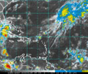
La Alborada - October 13. Different hurricane models in the US currently agree that hurricane Paula will turn east from the tip of Yucatan to enter Cuba at its western end, and will then curve down to the southeast, following the curve of Cuba itself.
The storm would cross Pinar del Rio and then south of Havana to Cienfuegos and Santa Clara, proceeding to Sancti Spiritus and Camagüey city. These are some of Cuba's major cities.
One model, however, places Paula on a beeline course to Havana and then Varadero, from where it would slingshot out of Cuba towards Bahamas and thence to the Atlantic Ocean. Varadero is the island's principal sun-and-surf resort.
The hurricane, now at Category 2, is projected to remain over the island from Wednesday until possibly Sunday. Its stay over land in Cuba will tend to reduce its power --hurricanes draw energy from warm waters--, but it seems clear that a large part of Cuba can expect high winds and much rain for an extended period.
The rain may benefit drought-affected agricultural areas, but any physical damage to fields and buildings would be hard to handle in areas impacted by the destructive storms of 2008.
The National Hurricane Center warned that the storm surge at the western point of Cuba, where the hurricane will touch land, will raise water levels by as much as 4 to 6 feet above normal tide levels along the immediate coast in areas of onshore flow. The surge, it predicted, will be accompanied by large and destructive waves.
AccuWeather's Interactive Hurricane Tracker offers a vivid map of the actual and projected track of Paula. Choose basin Atlantic and storm Paula at top right, adjust the scale at left. The map allows interactive activation of four
different models.
Source: http://groups.yahoo.com/group/CubaNews/message/118458
Comments