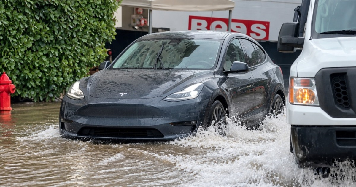
On Wednesday, South Florida is under a flood watch affecting Miami-Dade, Broward, and Palm Beach counties, which will remain in effect until Thursday night due to the potential for heavy rainfall and urban flooding. Several areas in the southern part of the state are already experiencing these conditions.
The National Weather Service (NWS) initiated this alert at 5 p.m. on Tuesday.
Early Wednesday morning, a flash flood warning was also issued for parts of southern Broward, as radar estimates indicated between eight to 11 inches of rain had already fallen, with an additional two to three inches possible.
Intense Rainfall and Flood Risks
Rain chances are high, ranging from 80% to 90% in Palm Beach and Broward, and around 70% in Miami. Wednesday is expected to be the peak of this rain event.
Overall, rainfall totals are predicted to range from two to four inches through Friday, with some areas potentially seeing six to eight inches, and isolated instances exceeding 10 inches.
The most severe storms could unleash one to two inches per hour, increasing the risk of sudden flooding, particularly in urban areas and places with poor drainage systems.
According to Telemundo 51, "the biggest issue will be the possibility of multiple rain bands hitting the same areas repeatedly. Where this happens, totals could be significantly higher, intensifying the risk of flash floods."
Weather Patterns Behind the Heavy Rains
The meteorological conditions are the result of a low-pressure system over the Gulf of Mexico, a nearly stationary front south of the Florida peninsula, and persistent east-northeast winds bringing abundant moisture from the Atlantic.
This setup encourages the formation of rain bands that can repeatedly move over the same locations, increasing precipitation totals.
Strong winds are also impacting maritime conditions.
On Tuesday afternoon, wind gusts exceeded 40 mph in parts of Broward, with Atlantic waters expecting waves between eight and 12 feet, and a high risk of rip currents.
Meteorologist Mike Watson from Surfline noted that the rough seas will continue until Thursday, though wind conditions might improve by Friday and Saturday.
Saturated Grounds Heighten Flood Threat
The flood risk is particularly severe in areas where previous rains have saturated the ground, reducing its ability to absorb additional moisture.
A CBS Miami meteorologist warned about conditions in areas like Deerfield Beach and Pompano Beach: "This region has completely saturated soils, so it doesn't take much rain to cause issues with standing water."
Florida has also seen recent bouts of extreme rainfall.
On November 1 and 2, areas like Malabar and Grant-Valkaria accumulated 24.10 and 23.69 inches of rain, respectively, in less than 48 hours.
How Long Will the Rain Continue?
The flood watch will persist until Thursday night. While rain may gradually decrease toward the weekend, there remains a possibility of new heavy downpours along the Atlantic coast.
Meteorologist Matt Devitt had warned about the risk of rainfall totals exceeding 10 inches in specific locations, particularly where multiple rain bands overlap for several days.
Authorities advise against driving on flooded roads due to unpredictable water depth and currents that can sweep vehicles away, even on seemingly passable routes.
Understanding the Flood Risks in South Florida
What areas in South Florida are currently under flood watch?
Miami-Dade, Broward, and Palm Beach counties are under flood watch due to heavy rainfall.
What weather conditions are causing the heavy rains in South Florida?
The heavy rains are caused by a low-pressure system over the Gulf of Mexico, a nearly stationary front south of Florida, and persistent winds bringing moisture from the Atlantic.
How much rain is expected during this weather event?
Rainfall amounts are expected to range from two to four inches, with some areas possibly seeing up to 10 inches.
What precautions should residents take during the flood watch?
Residents are advised to avoid driving on flooded roads due to unpredictable water depth and strong currents that can carry vehicles away.