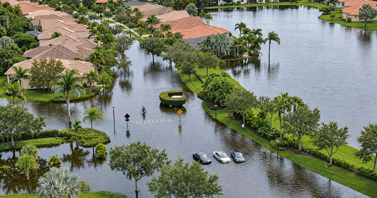
Florida is bracing for yet another flood threat this week, just a fortnight after heavy rains inundated homes, rendered roads impassable, and caused extensive damage across various communities.
The National Weather Service (NWS) in the United States forecasts rainfall accumulations ranging from 3 to 6 inches, with localized areas potentially receiving up to 12 inches (305 millimeters) along the state's east coast.
Meteorologist Matt Devitt issued a warning on Monday about the increased flood risk over the next seven days, especially in Atlantic coastal communities, where several weather models suggest the possibility of significant rainfall.
Devitt noted that while most areas might see rainfall between 3 and 6 inches (76 to 152 millimeters), some locations could receive less, and others could far exceed those amounts. "I'm observing early indications of potentially much higher totals in specific spots, possibly exceeding 10 inches, which could lead to flooding," he remarked.
However, he clarified that it's too early to pinpoint exactly where the heaviest rain will fall, despite the models suggesting such a possibility.
Flood Watch Issued for Nine Florida Counties
The threat was confirmed by the NWS in Melbourne, which issued a flood watch on Monday at 3:18 p.m. for nine counties in east-central Florida. The watch will take effect on Tuesday at 5:00 p.m. and remain in place until Friday, November 20, at 7:00 p.m., local time.
The areas include the counties of Volusia, Seminole, Orange, Osceola, Okeechobee, Brevard, Indian River, St. Lucie, and Martin. Cities like Orlando, Kissimmee, Sanford, Daytona Beach, Titusville, Cocoa Beach, Melbourne, Palm Bay, Vero Beach, Fort Pierce, Port St. Lucie, and Stuart are also covered under this watch.
The federal agency expects several rounds of rain and isolated storms through Friday, with general accumulations of 3 to 6 inches. However, certain areas could see between 8 and 12 inches (203 to 305 millimeters), mainly in coastal counties.
According to the NWS's meteorological analysis, the highest flood risk is expected between Wednesday, November 18, and Thursday, November 19, particularly along the coast south of Cape Canaveral.
Authorities warned that the rainfall could lead to flooding in rivers, streams, roads, and low-lying areas, especially where the ground remains saturated from previous downpours.
Palm Beach Under Watch; Flood Risk in Miami and Broward
In South Florida, the NWS office in Miami issued another flood watch for urban and coastal areas of Palm Beach County, effective from Tuesday, November 17, at 5:00 p.m. until Thursday, November 19, at 7:00 p.m.
This measure includes cities such as West Palm Beach, Boca Raton, Boynton Beach, Delray Beach, Jupiter, and Palm Beach Gardens. Rainfall predictions for these areas range from 2 to 4 inches, with higher accumulations of 6 to 8 inches and isolated peaks of up to 10 inches (254 millimeters).
The danger is heightened as some storms could linger over the same areas for hours, dropping 1 to 2 inches of rain per hour and causing flash floods.
The Miami meteorological office also highlighted an increased risk of urban flooding in parts of Miami-Dade, Broward, and Palm Beach between Tuesday and Thursday. However, the specific flood watch issued this Monday for Southeast Florida focuses on Palm Beach's metropolitan and coastal areas.
In addition to the rain, hazardous maritime conditions, high surf, and strong rip currents are expected along the Atlantic coast beaches for much of the week.
El Niño's Influence on Rainfall Patterns
Devitt linked the rising flood risk to the influence of El Niño, a climate phenomenon that alters atmospheric circulation patterns and can cause wetter-than-normal conditions in Florida during the winter.
The National Oceanic and Atmospheric Administration (NOAA) confirmed last Thursday that El Niño continues to strengthen, with a greater than 79% chance of reaching strong or very strong intensity between January and March 2027.
For the upcoming weather event this week, the NWS identifies a combination of low pressure systems, abundant moisture, and winds that could support the formation of persistent rain bands near the east coast. Meteorologists explained that the path and intensity of these systems will determine where the heaviest rain will fall, so forecasts may still change.
Florida Still Recovering from Recent Floods
This new threat arrives as many communities in central and southeastern Florida are still dealing with the aftermath of catastrophic flooding earlier in November, when the NWS declared a flash flood emergency in Palm Bay and West Melbourne, Brevard County.
Rainfall reached extraordinary levels, with preliminary measurements indicating 24.10 inches of rain fell in Malabar and 23.69 inches in Grant-Valkaria over roughly 48 hours—amounts nearly equivalent to half a year's usual precipitation in that region.
Palm Bay reported 20.60 inches, while Melbourne Beach accumulated 19.80 inches. Other communities also experienced exceptional rainfall, leading to flooded homes, stranded vehicles, road closures, and disruptions to public services.
The disaster's magnitude prompted Governor Ron DeSantis to declare a state of emergency in seven counties on November 2 through Executive Order 26-227. Two days later, on November 4, he expanded the declaration to include a total of 14 counties via Executive Order 26-228.
Subsequently, the state government requested a federal major disaster declaration to secure additional resources for the affected communities.
The concern is that new rainfall could exacerbate damage in areas where the ground is still saturated, roads remain damaged, and families have yet to recover from the previous storm.
Understanding Florida's Flood Threats
What areas in Florida are under the highest flood risk this week?
The highest flood risk is expected in the coastal areas of east-central Florida, particularly south of Cape Canaveral, between Wednesday and Thursday.
How does El Niño contribute to increased rainfall in Florida?
El Niño affects atmospheric circulation patterns, leading to wetter-than-normal conditions in Florida during the winter, increasing the likelihood of heavy rains and flooding.
What measures have been taken to address the flooding in Florida?
Governor Ron DeSantis declared a state of emergency in several counties, and the state requested a federal major disaster declaration to secure additional resources for affected communities.