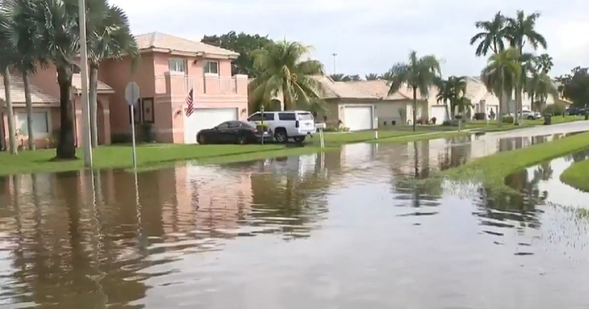
The National Weather Service (NWS) in Miami issued a flash flood warning for the northeastern part of Palm Beach County on Sunday at 5:23 p.m. Eastern Time. This warning is in effect until 7:15 p.m. on the same day.
Identified by the official code KMFL.FF.W.0007, the warning is based on data from Doppler radar and automated rain gauges. These instruments recorded between 2.5 and 3.5 inches of rain accumulated in the area at the time of issuance.
The NWS forecasted an additional rainfall rate of 1.5 to 2 inches within the next hour, with the possibility of another 1 to 2 inches following that. The bulletin warned that flash flooding was either occurring or could begin immediately.
Areas at Risk of Severe Thunderstorms
Thunderstorms pose a significant threat to creeks and small streams, urban areas, roads, streets, underpasses, and low-lying or poorly drained areas.
The warning encompasses several localities, including West Palm Beach, Palm Beach Gardens, Riviera Beach, North Palm Beach, Lake Park, Haverhill, Cloud Lake, Port of Palm Beach, Golden Lakes, Lake Belvedere Estates, Royal Palm Estates, the President Donald J. Trump International Airport, Downtown West Palm Beach, Gun Club Estates, Mangonia Park, Glen Ridge, Lakeside Green, and Cypress Lakes.
The bulletin does not report any airport closures, flight disruptions, evacuations, or specific road blockages. The inclusion of the airport in the warning area is solely due to its geographical location within the advised zone.
Warning Distinct from Regional Flood Watch
This warning is separate and independent from the regional flood watch that the NWS has been maintaining since the morning for Miami-Dade, Broward, and Palm Beach counties, which is set to continue through Monday afternoon. While the watch alerts to conditions favorable for flooding, the warning indicates that flooding is currently happening or is imminent, requiring immediate action.
Additionally, this warning should not be confused with another issued the same Sunday by the NWS in Melbourne for the southeast of Okeechobee County, where floods rendered sections of SR 70 and US 441 impassable, and water entered structures. Those impacts belong to a completely separate event and do not apply to northeast Palm Beach.
Impact of Saturated Grounds and Time Change
The situation is exacerbated by the already saturated ground, following weeks of persistent rainfall and exceptionally high tides in South Florida since mid-October, reducing drainage capacity and speeding up surface water accumulation.
Compounding the issue is the time change that took effect in Florida on Sunday, advancing nightfall by approximately an hour and reducing drivers' visibility in the rain during the evening.
The NWS safety message is unequivocal: "Turn around, don't drown when encountering flooded streets. Most flood-related deaths occur in vehicles."
Understanding Flash Flood Warnings in Palm Beach
What does a flash flood warning mean?
A flash flood warning is issued when flash flooding is occurring or is imminent. It requires immediate action to protect life and property.
How does the flash flood warning affect transportation in Palm Beach?
While the warning does not specify road closures, drivers should exercise caution as streets may become quickly inundated, making travel hazardous.
Why is the airport included in the flash flood warning area?
The airport is included due to its location within the geographical area affected by the warning, although no specific disruptions have been reported.