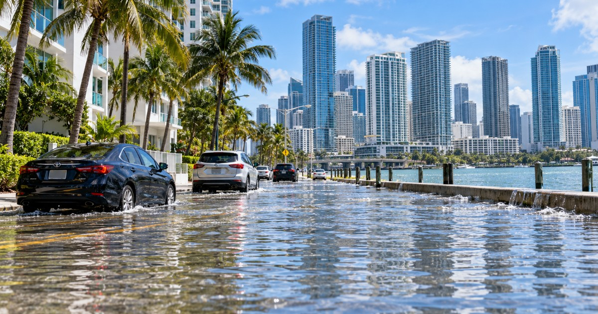
South Florida is experiencing its last relatively calm day this Thursday before a stationary front loaded with tropical moisture transforms the weekend into one of the wettest this fall. Forecasts from Fox Weather and CBS Miami predict 3 to 5 inches of rainfall through Monday across Miami-Dade, Broward, and Palm Beach.
On Thursday, the high temperatures are expected to hover around 90 °F, but with humidity, the heat index might soar to 100 °F in the afternoon. CBS Miami suggests staying hydrated, as "heat indices will surge into the high 90s and the 100s in the afternoon when considering the humidity."
Eastern winds will blow with gusts ranging from 15 to 20 mph, and the risk of rip currents is low at Miami-Dade and Broward beaches, though the National Weather Service (NWS) maintains a high risk in Palm Beach until 8 p.m.
Friday will see scattered showers driven by the breeze, with highs in the upper 80s and a heat index approaching 97 °F. While manageable, it hints at what's to come.
Saturday's Stormy Outlook
Saturday brings a dramatic shift: an 80% chance of rain, with scattered to widespread storms and downpours possibly delivering 2 to 4 inches in just 24 hours in Miami-Dade and Broward, according to the NWS's worst-case scenario. CBS Miami bluntly states: "Saturday looks soaked, with scattered storms that could produce heavy downpours."
Sunday is poised to be the most challenging day of the weekend. Storms will sweep across the region, with a 90% chance of rain and gusts potentially reaching 30 mph or more.
"The likelihood of rain is even higher on Sunday, with more widespread storms and the potential for heavy rains and localized flooding," warns CBS Miami. The unstable pattern will linger into the following week.
Understanding the Weather Dynamics
The driving force behind this weather is a decaying front that remains stationary over South Florida, combined with high pressure that tightens the gradient over the peninsula. This results in easterly winds of 30 to 40 mph along the Atlantic coast from Daytona Beach to Miami-Dade.
Fox Weather has issued a level 1 out of 4 threat for flash flooding across the entire eastern coast of Florida. It's crucial to note that this is not a tropical system, but rather frontal rain with deep tropical moisture.
Conditions at beaches and for marine activities will be hazardous throughout the weekend: high surf, rip currents, and strong onshore winds. While the NWS hasn't issued a formal flood alert for the entire region, it does warn of localized flooding in urban areas with poor drainage.
Areas at Risk
Historically vulnerable areas in Miami-Dade include Hialeah, Sweetwater, Brickell, Downtown Miami, and Miami Beach, as well as Doral, Medley, Tamiami, Kendall, and Coral Gables.
Depressed roadways and low streets near canals are the most critical points. The advice is clear: never drive your vehicle into a flooded street, even if it appears shallow.
Beyond the weekend, the next high tides are expected from October 24 to 30, peaking on October 26 and 27 near the full moon. Fox Weather warns that this weekend's rains and onshore winds could elevate water levels and foreshadow the effect of those tides, causing moderate coastal flooding in Atlantic coast communities even without additional rain.
It's worth remembering that standard homeowner insurance does not cover flooding, and new policies under the National Flood Insurance Program (NFIP) have a 30-day waiting period before they take effect. Therefore, those without coverage cannot secure it in time for this event.
Understanding Miami's Weekend Weather Challenges
What is causing the wet weekend weather in Miami?
A stationary front, combined with high pressure, is causing strong easterly winds and significant rainfall, making this weekend particularly wet in Miami.
Which areas in Miami-Dade are most vulnerable to flooding?
Locations such as Hialeah, Sweetwater, Brickell, Downtown Miami, Miami Beach, Doral, Medley, Tamiami, Kendall, and Coral Gables are historically more prone to flooding.
Is the heavy rain in Miami related to a tropical system?
No, the heavy rain is due to a frontal system combined with tropical moisture, not a tropical storm or hurricane.