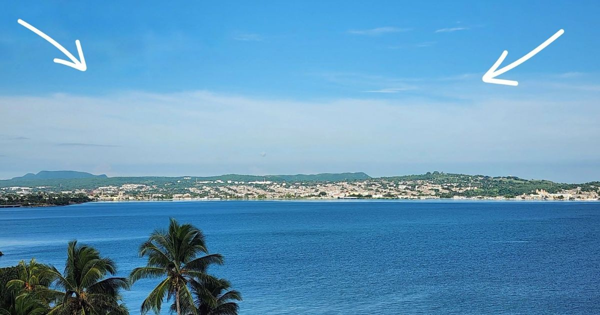
This past Friday, residents of Matanzas witnessed an unusual atmospheric occurrence related to the powerful Hurricane Isaias, despite the storm's center being hundreds of kilometers away in the Gulf of Mexico, as it continues its journey toward the U.S. northern coast.
Henry Delgado Manzor, an aeronautical meteorologist and member of the Cuban Societies of Meteorology and Speleology, shared on Facebook that this phenomenon is known as the "cirrus focus" of the hurricane. These high clouds extend far from the system's center.
"From Matanzas, one can see the cirrus focus linked to the intense Hurricane Isaias, which is positioned in the Gulf of Mexico. Its high-altitude clouds reach even western Cuba," noted Delgado Manzor.
Cirrus clouds are high, thin formations primarily made of ice crystals. In the context of a significant tropical cyclone, they can stretch from the storm's upper areas and travel far from its core, making them visible from regions not directly experiencing the hurricane's center.
Delgado Manzor pointed out that this atmospheric phenomenon was studied in the 19th century by Father Benito Viñes, a pioneering meteorologist in the Caribbean, who was one of the first to study tropical cyclones.
Viñes observed that cirrus clouds rotated around hurricanes and were pulled outward from the massive cloud cover over the cyclone's center. Tracking their movement helped meteorologists of that era deduce the hurricane's center location and its path, long before modern technology like weather satellites and hurricane hunter aircraft were available.
"Father Viñes was an astute observer, a wise man indeed!" Delgado Manzor remarked.
As Isaias undergoes a particularly hazardous phase in the Gulf of Mexico, these observations in Matanzas continue. The storm escalated to a Category 3 hurricane on Friday, with maximum sustained winds of 195 km/h, as verified by the United States' National Hurricane Center (NHC).
The storm's intensification was confirmed by data from a U.S. Air Force Reserve hurricane hunter aircraft as it progressed toward the Gulf's northern coast. The NHC anticipated that Isaias would remain a dangerous hurricane as it approached landfall.
The agency also predicted a potential storm surge flooding of up to 2.7 meters between the Alabama-Florida border and Grayton Beach, provided the highest surge coincides with high tide.
In addition to the surge, forecasts included heavy rain, flash floods, and tornado risks in parts of northwestern Florida, Alabama, and other areas near the cyclone's path.
The NHC expected Isaias's center to reach the hurricane warning area late Friday or early Saturday. Meanwhile, hundreds of kilometers away from the expected impact zone, its high-altitude clouds continue to cast a visible mark over western Cuba.
Understanding Hurricane Isaias and Its Impacts
What is the "cirrus focus" phenomenon observed in Matanzas?
The "cirrus focus" refers to high-altitude cirrus clouds associated with Hurricane Isaias, which extend far from the storm's center, allowing them to be seen from locations like Matanzas, far from the hurricane itself.
How did Father Benito Viñes contribute to meteorology?
Father Benito Viñes was a pioneering meteorologist in the Caribbean during the 19th century. He studied the movement of cirrus clouds around hurricanes, helping to determine the storms' centers and paths before the advent of modern technology.
What are the potential impacts of Hurricane Isaias as it approaches the U.S. coast?
Hurricane Isaias is expected to bring dangerous storm surges, heavy rainfall, flash flooding, and potential tornadoes to areas in northwestern Florida, Alabama, and surrounding regions.