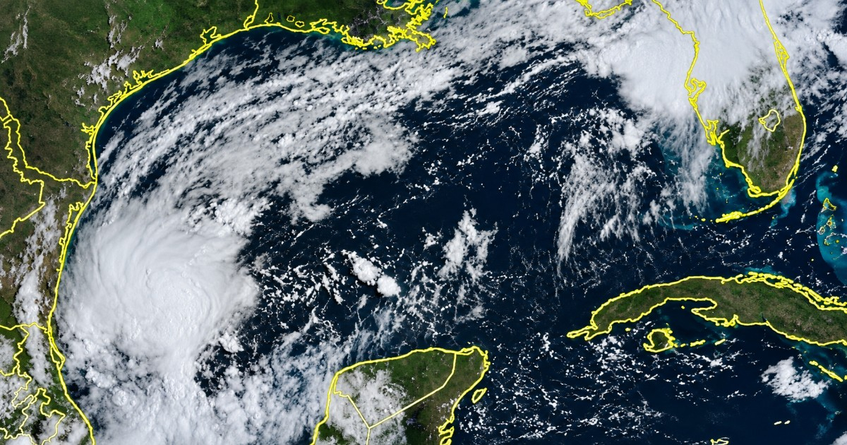
The United States National Hurricane Center (NHC) announced on Tuesday that Tropical Depression Nine has formed in the southwestern Gulf of Mexico. It has issued warnings about the increasing threat of hazardous winds and storm surges for the northern Gulf Coast, stretching from Louisiana to the Florida Panhandle.
Upon its formation, the system was observed to have maximum sustained winds of 35 mph (55 km/h) and a central pressure of 1,007 mb. The center of the depression was located roughly 610 km west of Progreso, Mexico, and approximately 1,015 km southwest of the mouth of the Mississippi River.
The NHC has predicted that the depression will intensify over the coming days, potentially evolving into a tropical storm by Wednesday, at which point it would be named Isaias. Should this development occur, the system could reach hurricane strength by Thursday, becoming the first hurricane of the 2026 Atlantic season—a season that has produced eight named storms so far without any reaching hurricane status.
The projected path of the system indicates it will move past the northern Yucatán Peninsula on Thursday and approach the northern Gulf Coast of the U.S. by Friday or Saturday.
Potential Impact on Gulf Coast Communities
The NHC has cautioned that watches might be issued as early as Wednesday and has advised residents within the affected areas to activate their hurricane emergency plans. "Everyone from Louisiana to the Florida Panhandle should keep a close watch on this system. It could bring dangerous winds, storm surges, and rainfall-induced flooding to those regions," the NHC stated in a video released on Tuesday.
Regarding rainfall, the center forecasts that accumulations of three to six inches (75-150 mm) are expected in the central Gulf Coast of the U.S. between Friday and the weekend, with isolated maximums of up to 10 inches (254 mm) in some areas, raising the risk of flash, urban, and river flooding.
Expert Warnings and Rapid Development
Cuban meteorologist José Rubiera had highlighted the system’s potential from Monday, noting that the most probable impact zone in the U.S. lay between Mississippi and Alabama, though there remains considerable uncertainty in the trajectory.
The probability of the system forming surged from a mere 10% to 90% within less than 24 hours, showcasing an exceptionally rapid organization that took many prediction models by surprise.
Historically, October is one of the most active months of the Atlantic hurricane season, and the northern Gulf Coast—with its low and flat topography—is particularly susceptible to storm surges.
The NHC has advised residents of the region to keep track of forecast updates on hurricanes.gov and ensure their emergency plans are ready before the system approaches the coast this weekend.
Frequently Asked Questions About Tropical Depression Nine
What is the current status of Tropical Depression Nine?
Tropical Depression Nine has formed in the southwestern Gulf of Mexico with maximum sustained winds of 35 mph and is expected to intensify into a tropical storm soon.
Where is Tropical Depression Nine expected to make landfall?
The system is projected to move past the northern Yucatán Peninsula on Thursday and approach the northern Gulf Coast of the U.S., potentially affecting areas from Louisiana to the Florida Panhandle.
What precautions should residents in the affected areas take?
Residents should monitor updates and activate their hurricane emergency plans as watches could be issued soon. They should prepare for potential hazardous winds, storm surges, and flooding.