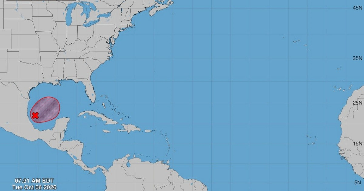
The United States National Hurricane Center (NHC) announced on Tuesday morning that there is now a 90% chance of a tropical depression forming in the southwestern Gulf of Mexico, as per their official bulletin released at 8:00 a.m. EDT.
Previously labeled as AL92, this system has rapidly intensified from a minor threat to a major weather concern for the southern United States and the western Caribbean within less than a day.
Swiftly Organizing System
The NHC's bulletin described the system as having showers and thunderstorms that are beginning to show signs of organization around a broad area of low pressure situated in the southwestern Gulf of Mexico. The system's potential development shot up remarkably—from a mere 10% chance early Monday morning, it climbed to 60% by 2:00 p.m., and 70% by 8:00 p.m. On Tuesday morning, probabilities for development within both 48 hours and seven days were set at a high 90%.
The NHC anticipates that the system will continue to develop, evolving into a tropical depression in the coming days as it moves eastward.
Projected Path: Yucatán First, Northern Gulf Coast Next
According to the NHC, this low-pressure area may bring strong winds and heavy rainfall to the western regions of Mexico's Yucatán Peninsula within a couple of days. Following this, the disturbance is expected to turn north or northeast, heading toward the northern Gulf Coast by the end of the week. The advisory stressed the need for vigilance, stating, "It's still too early to pinpoint the exact impacts on the northern Gulf Coast, but residents from northwest Florida to Louisiana should closely monitor this system's progress."
Meanwhile, Florida was already experiencing heavy rains impacting the northern and northwestern parts of the state, adding another layer of concern for residents.
Reconnaissance Flights to Gather Data
To better understand the system's environment, the NHC reported that a NOAA Gulfstream aircraft is scheduled to collect samples over the Gulf later today, and an Air Force reconnaissance plane will investigate the system tomorrow. These missions aim to gather direct data on the system's structure and wind patterns, enhancing forecast accuracy in the coming hours.
Warning from Expert Meteorologist
Cuban meteorologist José Rubiera had already warned on Monday night that the system 92L is "very likely to become a tropical cyclone" and might at least achieve tropical storm status. Rubiera projected the highest impact probability between Mississippi and Alabama, extending from Louisiana to northwest Florida. While some models predict strengthening to hurricane status, Rubiera remained cautious, noting that "this can change significantly since the cyclone is not yet fully formed."
Should AL92 escalate to tropical storm intensity, it would be named Isaías, though this has not been officially confirmed by the NHC, as reported by outlets like the Orlando Sentinel.
A Calm Season That Could Shift
The emergence of AL92 is notable against the backdrop of an unusually calm Atlantic hurricane season in 2026. By October 4, eight named storms had formed, none reaching hurricane status—a phenomenon not seen since 1914. The El Niño effect has been identified as a primary factor in this tranquility, increasing vertical wind shear over the Atlantic. The hurricane season officially extends until November 30, and AL92 might become the first significant system in a year that has defied all predictions for high activity.
Key Questions on Potential Tropical Depression in Gulf
What is the current status of the system in the Gulf?
The system, designated AL92, has a 90% probability of developing into a tropical depression, according to the latest NHC advisory.
What areas are expected to be affected by the system?
The system could impact the western Yucatán Peninsula with heavy rains and strong winds, before potentially moving towards the northern Gulf Coast, affecting areas from northwest Florida to Louisiana.
What measures are being taken to monitor the system?
NOAA and Air Force reconnaissance flights are planned to collect data to improve forecast accuracy, focusing on the system's environment and wind structure.