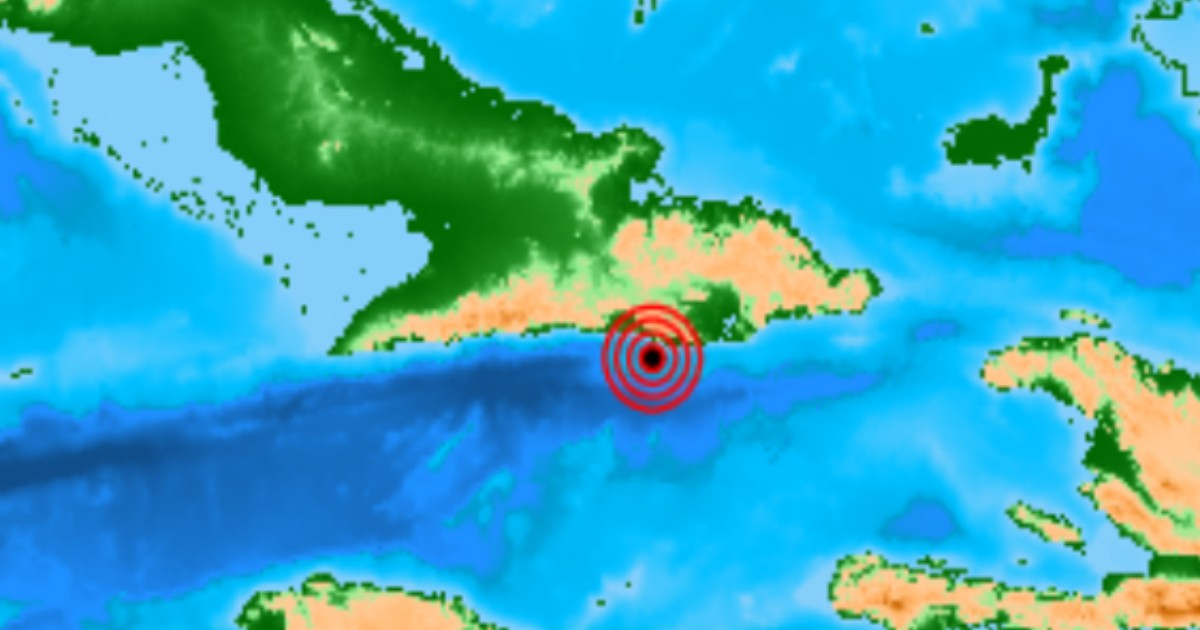
A tremor measuring 3.6 on the Richter scale was observed this Friday in Cuba's eastern region, with its epicenter located 31 kilometers southeast of Santiago de Cuba, as reported by the National Center for Seismological Research (CENAIS).
The seismic activity was recorded at 5:13 p.m. local time and was classified as noticeable, meaning that residents in the area were able to feel it.
CENAIS detailed that the earthquake's focus was at a depth of 10 kilometers, with coordinates of 19.807° latitude north and -75.634° longitude west. Fortunately, there were no reports of material damage or casualties linked to the event.
Enrique Diego Arango Arias, head of Cuba's National Seismological Service, noted that the tremor was felt in various parts of Santiago de Cuba and its surroundings.
Just three days prior, on August 18, a false seismic alarm caused widespread panic in Cuba. Thousands of mobile phones across the country received a baseless earthquake alert.
CENAIS quickly debunked the false alarm, stating, “No earthquake occurred in Cuba on Tuesday, August 18, 2026.” The Civil Defense labeled the notification as “completely false.”
Enrique Diego Arango Arias confirmed that no seismic activity justified the alert according to the network stations.
Google denied any involvement in sending the notification through its Android alert system, clarifying that no earthquake was detected nor alerts sent in Cuba. An unofficial hypothesis suggested that an internal test by ETECSA might have inadvertently escaped its controlled environment.
On the same Friday, before the actual earthquake, Arango issued a public caution regarding the previous false alert, emphasizing that “Cuba's National Seismological Service does not have a protocol to send earthquake alerts through any national or foreign communication entities.”
Recent Seismic Activity in Eastern Cuba
This recent earthquake is part of a year marked by significant seismic activity in eastern Cuba. On February 8, a 5.6 magnitude quake occurred, followed by approximately 30 aftershocks within the first two hours. On March 17, a magnitude 6.0 tremor struck the region, resulting in over 160 aftershocks. Moreover, July 24 witnessed the ninth noticeable quake of the year in Santiago de Cuba, with a magnitude of 3.1.
Santiago de Cuba holds the highest seismic risk in the nation. Its proximity to the Oriente fault—also known as the Bartlett-Cayman fault, which lies between the Caribbean and North American tectonic plates—makes eastern Cuba the epicenter for about 70% of the country’s seismic activity and the most historically significant earthquakes recorded on the island.
CENAIS warned that, given the heightened public sensitivity following the August 18 false alarm, it is crucial to establish clear, official communication protocols for real seismic events.
Frequently Asked Questions about Seismic Activity in Santiago de Cuba
What was the magnitude of the recent earthquake in Santiago de Cuba?
The recent earthquake in Santiago de Cuba had a magnitude of 3.6 on the Richter scale.
Did the earthquake in Santiago de Cuba cause any damage?
No reports of material damage or casualties were associated with the earthquake in Santiago de Cuba.
What is the Oriente fault?
The Oriente fault, also known as the Bartlett-Cayman fault, is a tectonic boundary between the Caribbean and North American plates, located near Santiago de Cuba, responsible for much of the region's seismic activity.