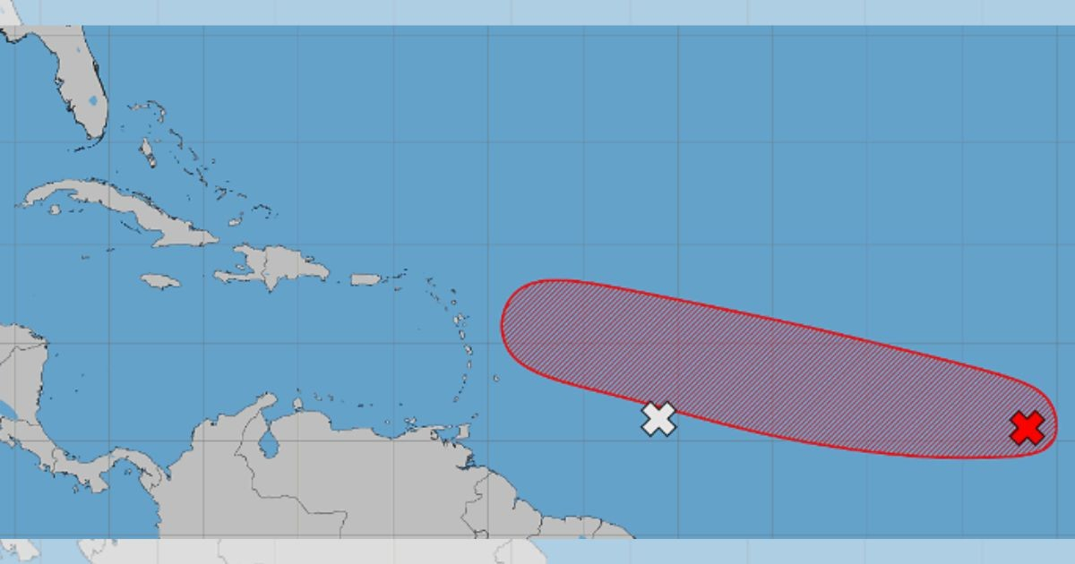
An area of low pressure located in the central tropical Atlantic is currently holding a 70% likelihood of developing over the next week as it moves in a west-northwest direction toward the Caribbean islands.
As of Tuesday, the system was approximately 500 miles southwest of the Cape Verde Islands, according to a morning update from the United States National Hurricane Center (NHC).
While it is still too early to determine its exact path and potential impacts, images from the NHC indicate that the possible development area is extending westward toward the Antilles, suggesting that Cuba should monitor its progress closely in the coming days.
The monitoring center anticipates the potential formation of a tropical depression by the latter part of this week as the system traverses the central tropical Atlantic.
The chance of development over the next 48 hours stands at 30%, while the seven-day forecast maintains a 70% probability.
Currently, the low-pressure system is associated with limited rain and thunderstorm activity. However, environmental conditions are expected to become more conducive to its organization over the next couple of days.
The elevated probability was sustained from Monday night, when the likelihood of formation was raised to 70%. Earlier, the forecast had been at 60% for seven days and 20% for the initial 48 hours.
The system has shown a consistent increase in its chances of organization, climbing from 40% on Sunday morning to 50% in the afternoon, and reaching 60% on Monday before rising to the current level.
The NHC is also monitoring another tropical wave situated about 600 miles east of the Windward Islands, which is accompanied by disorganized rain showers and thunderstorms. This second system is moving into a region with a large mass of dry air, diminishing its development prospects to nearly 0% for both the next 48 hours and the upcoming week.
Though not expected to evolve into a tropical depression, the wave might bring locally heavy rain and gusty winds to the Lesser Antilles in the next two days.
A third area under observation is a trough of low pressure several hundred miles northeast of Bermuda. This system is producing rain and thunderstorms as it moves eastward at approximately 20 miles per hour.
Its development chances remain at 10% for both the next 48 hours and seven days. The NHC predicts that the system will encounter cooler waters by Thursday, likely ending any chance of further organization.
FAQs on Potential Caribbean Weather Systems
What is the current chance of the system developing into a tropical depression?
The system holds a 70% chance of developing into a tropical depression in the next seven days, and a 30% probability within the next 48 hours.
Is Cuba at risk from the developing system?
While the exact path is yet to be determined, Cuba should monitor the system as it is moving toward the Antilles, potentially affecting the region.
What about the other tropical wave near the Windward Islands?
The second tropical wave is encountering dry air, which reduces its chances of development to nearly 0%, though it could bring heavy rain and wind to the Lesser Antilles.