The National Hurricane Center (NHC) issued its first official alerts of the 2026 Atlantic hurricane season on Tuesday for Potential Tropical Cyclone One. This system is already causing dangerous flash floods in parts of Texas and Louisiana and is expected to make landfall in eastern Texas or southwestern Louisiana early Thursday morning.
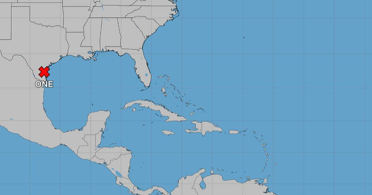
As of 4:00 PM Central Time, the system was located at coordinates 27.3°N 97.6°W, about 65 miles southwest of Corpus Christi, Texas. It was moving northeast at a slow pace of six mph, with maximum sustained winds of 30 mph and a minimum pressure of 1,005 mb.
The NHC has issued a Tropical Storm Warning for the Louisiana coast from Sabine Pass to Morgan City, along with a Tropical Storm Watch stretching from Sargent, Texas, to Sabine Pass.
Flooding: The Primary Threat
Rather than strong winds, the main danger posed by this system is the potential for heavy rainfall. The NHC has forecast rainfall totals of five to ten inches, with isolated areas potentially receiving up to 20 inches. This could trigger severe flash and urban flooding from the upper Texas coast all the way through central and southern Louisiana, Mississippi, and Alabama over the coming days.
"We are facing several days of potentially deadly flash flooding along parts of the Gulf Coast, from mid to upper Texas to much of central Louisiana, central Mississippi, extending to central Alabama," the NHC warned in a video update released on Tuesday.
Storm Surge and Coastal Concerns
A storm surge of two to four feet above ground level is expected between Port Bolivar, Texas, and Morgan City, Louisiana, particularly if peak surge coincides with high tide.
The NHC has determined that the system is unlikely to strengthen into a hurricane before landfall, given it will only have about 24 hours over open Gulf waters.
Nighttime Flooding Risks
The meteorological agency has also issued a specific warning regarding nighttime flooding: "Remember that most flash flood deaths occur in vehicles at night. Activate wireless emergency alerts on your smartphone, have a NOAA weather radio, and please stay safe."
Meanwhile, the Cuban Meteorological Institute (INSMET) confirmed on Tuesday that the system poses no threat to the island. According to the Cuban agency, the low-pressure area is situated very near the northeastern Mexican coast and southern Texas, already producing heavy rains from northeastern Mexico to southwestern Louisiana.
INSMET indicated that over the next 12 to 24 hours, the system will move into northwestern Gulf waters, where it will encounter "slightly favorable oceanic-atmospheric conditions for its development, potentially forming into a tropical cyclone by this afternoon or early Wednesday."
This marks the first official warning of the 2026 Atlantic hurricane season, which kicked off on June 1. The NOAA had predicted in May a below-average season, expecting between eight and 14 named storms, three to six hurricanes, and one to three major hurricanes, with a 55% chance of below-normal activity compared to historical averages.
The term "Potential Tropical Cyclone" is a designation used by the NHC for systems not yet organized as a tropical cyclone but already posing coastal threats requiring alerts. Jefferson Parish in Louisiana has issued a flood warning effective until Friday morning.
Understanding Potential Tropical Cyclone One
What is a Potential Tropical Cyclone?
A Potential Tropical Cyclone is a system that hasn't yet developed into a tropical cyclone but poses immediate threats like heavy rainfall or coastal flooding, prompting the NHC to issue alerts.
Why is flooding a major concern with this system?
The system is expected to bring torrential rains with potential accumulations up to 20 inches in some areas, leading to dangerous flash and urban flooding across several states.
What precautions should residents take during nighttime floods?
Residents should avoid driving during nighttime floods, activate emergency alerts on their phones, and ensure they have a NOAA weather radio to stay informed and safe.