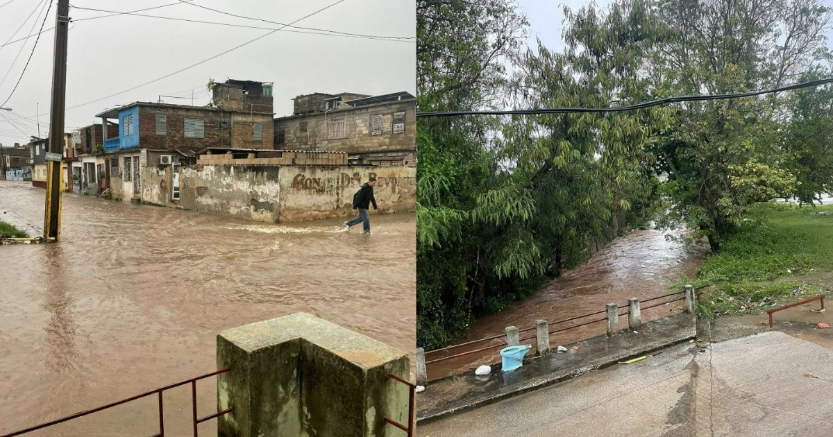
This past Saturday, heavy rains once again led to the flooding of Holguín's streets. The river running through Mendieta Street overflowed, leaving muddy water between 12 and 20 inches deep in the heart of the urban area.
Local resident Pedro Lorenzo Hechavarría Pupo captured the scene in photos shared on Facebook, cautioning that even after the rain stopped, the threat persisted: "In Holguín, after the rain ceased and the river receded from Mendieta Street, the river that crosses the street continued to flow with great force."
The images reveal murky brown water carrying plastic debris, trash, and sediments along streets lined with dilapidated buildings, zinc roofs, and electric poles with overhead wires.
Continued Weather Challenges in Holguín
This incident was not isolated. June 2026 has proven particularly harsh for this eastern province. Since the fourth of the month, flooded homes and isolated neighborhoods were reported in the municipality of Cueto. By the eighth, the rains had damaged the roof of the historic San Isidoro Cathedral, restricting access to the chapels of the Sagrario and the Virgen de la Caridad.
On the ninth, a surge in the Marañón River was described by local media outlet La Antena as alarming, with the water level rising "considerably" and visibly, causing concern among locals.
Persistent Meteorological Systems
A lingering trough over the eastern region was identified by the newspaper Granma as the meteorological system responsible for the ongoing rains, which also kept the likelihood of rainfall high in Guantánamo and the northern area of Holguín.
The municipality of Sagua de Tánamo, also within the province, experienced flooding described on social media as catastrophic during the same period.
Structural Vulnerabilities and Historical Context
Holguín's susceptibility to rains is rooted in its infrastructure. The Marañón and Jigüe rivers, which form the Holguín River, run through densely populated areas such as Alcides Pino, Vista Alegre, and Pueblo Nuevo, posing a constant hydrological threat.
Historically, June is among the rainiest months for the province, with totals nearing 266 mm and rainfall occurring on 15 to 22 days of the month, coinciding with the start of the hurricane season.
The deteriorating infrastructure exacerbates each event: inadequate drainage systems, poorly maintained buildings, and neglected river channels turn every storm into a crisis for residents.
In November 2023, heavy rains damaged more than 2,800 homes in the province, and Hurricane Melissa in 2025 left over 7,500 homes damaged, highlighting the cumulative magnitude of the issue in the absence of structural solutions from the authorities.
Understanding Holguín's Flooding Challenges
What caused the recent flooding in Holguín?
The recent flooding in Holguín was caused by heavy rains leading to the overflow of the river that runs through Mendieta Street, resulting in muddy water accumulating in the urban area.
How does infrastructure affect Holguín's flood risk?
The inadequate drainage systems, poorly maintained buildings, and neglected river channels in Holguín exacerbate the flood risk, turning heavy rains into emergencies for residents.
What are the historical patterns of rainfall in Holguín?
June is typically one of the rainiest months in Holguín, with precipitation totals nearing 266 mm and rainfall occurring on 15 to 22 days, aligning with the beginning of the hurricane season.