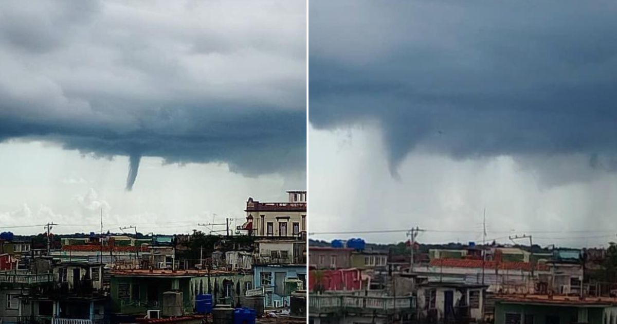
A high-altitude waterspout surprised the residents of Pinar del Río this Wednesday afternoon, as reported by Cuban meteorologist Raydel Ruisánchez on his Facebook page.
Ruisánchez elaborated that the phenomenon briefly manifested around 2:10 PM, facilitated by the lingering atmospheric instability in western Cuba.
This instability arises from a nearly stationary front along the northern coast, currently in the process of dissipating.
The details and images of the event were shared by meteorologist Osniel Armas, who clarified that it was indeed a high-altitude waterspout, not a tornado.
High-altitude waterspouts, unlike tornadoes, form from cumuliform clouds and do not make contact with the ground, typically causing no damage.
Nevertheless, their presence signifies strong upward currents and unstable atmospheric conditions.
The phenomenon was visible from various locations, capturing the attention of locals who watched the formation in the sky before it faded minutes later.
The sighting in Pinar del Río adds to a series of similar phenomena that have intrigued different regions across the country.
Recently, in the municipality of Los Cruces, Cienfuegos, residents observed a similar structure rising from cumuliform clouds without reaching the ground, amid conditions marked by high humidity and heat.
Such events have also surprised coastal residents. A marine waterspout was spotted off the coast of the Isla de la Juventud, drawing significant attention due to its proximity to the beach, though it caused no harm.
These occurrences are often linked to intense local storms and the interaction of warm and cold air masses.
In northern Pinar del Río, two consecutive waterspouts were seen in the sky over Mantua, astonishing locals who managed to capture photographs of the vortices formed over the sea. Although they did not touch the ground, these phenomena reflect the high energy accumulated in the atmosphere during summer afternoons.
To the south of the capital, a high-altitude waterspout was also spotted in the Calimete area, visible from several municipalities in Havana. Meteorologists noted that while these events are visually striking, they do not pose an immediate threat unless they develop into tornadoes.
Understanding High-Altitude Waterspouts in Cuba
What is a high-altitude waterspout?
A high-altitude waterspout forms from cumuliform clouds and does not reach the ground, typically causing no damage, unlike tornadoes.
Why are high-altitude waterspouts significant?
They indicate strong upward air currents and unstable atmospheric conditions, providing insight into weather patterns without posing immediate danger.
How do high-altitude waterspouts affect the weather in Cuba?
These phenomena are often associated with intense local storms and can signal the interaction of warm and cold air masses in the region.