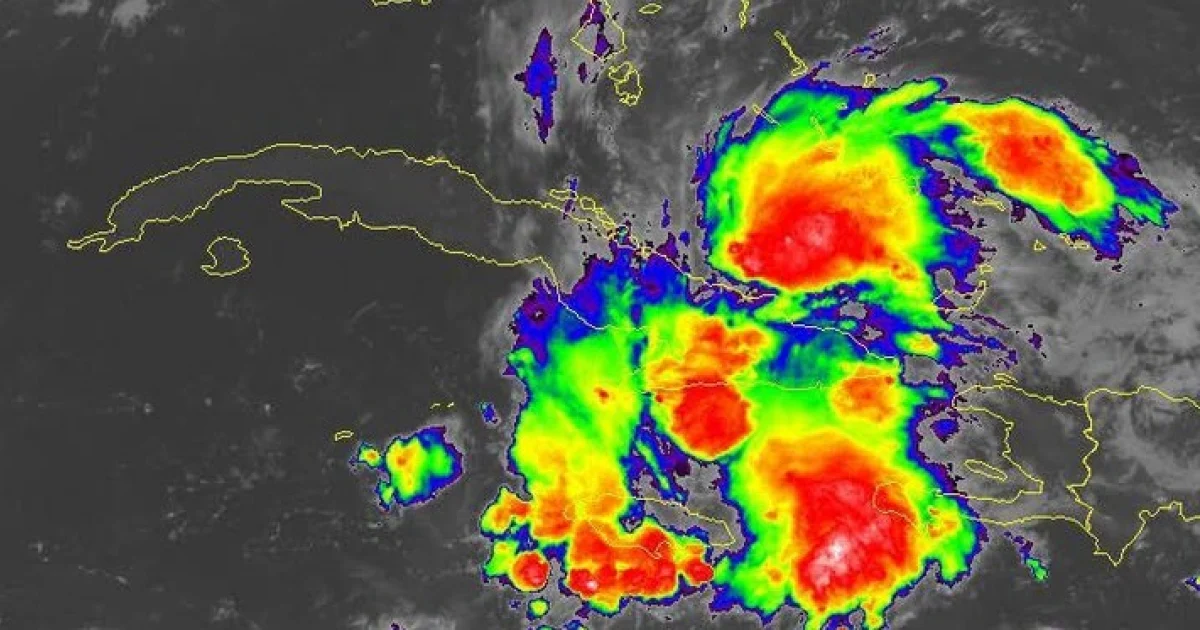
Eastern Cuba is currently facing a substantial increase in rainfall and thunderstorms due to the influence of a tropical wave linked to Potential Cyclone Nine, as reported by meteorologists and social media updates. Jorge Félix Hernández, an expert in the field, noted that intense and heavy rain areas are impacting regions such as Santiago de Cuba, Guantánamo, and Holguín.
Weather specialist Raydel Ruisanchez emphasized the need for heightened vigilance due to the likelihood of showers, rain, and thunderstorms throughout Friday and into Saturday morning. He forecasted that rainfall could range from 50 to 100 mm in the eastern region, with Santiago de Cuba and Guantánamo potentially experiencing 150 to 200 mm, and isolated areas in Guantánamo seeing between 300 and 400 mm, posing a significant risk of flash floods.
Meanwhile, the Institute of Meteorology (INSMET) confirmed in its Saturday report that the skies will be cloudy from Camagüey to Guantánamo, with showers intensifying in the afternoon and spreading to the central region. In the western part of the country, less cloud cover is expected at dawn, although it will increase partially during the day, with isolated rainfall in the afternoon.
The northern eastern coast will experience rough seas, with local surges in wind strength and wave height in areas with rain and thunderstorms.
Residents Share Experiences Amid Heavy Rains
Residents from eastern Cuba have taken to social media to share their experiences with the heavy rains. In Contramaestre, Santiago de Cuba, the rain began at 2:00 am accompanied by thunderstorms. Intense rain and numerous thunderstorms have been reported in Granma, with rain starting at 5:26 am in Bayamo, at 4:30 am in Jiguaní, and as early as 11:00 pm on Friday in Manzanillo.
Guantánamo also saw steady, heavy rain beginning in the early hours. Communities such as Marcané (Cueto, Holguín), Imías (Guantánamo), Palma Soriano, Tercer Frente, Mangos de Baraguá, and Los Negros (Contramaestre) in Santiago de Cuba reported heavy rainfall, while some areas in Las Tunas and Holguín experienced only light drizzles.
Potential Cyclone's Impact on Eastern Region
INSMET issued a special advisory on Friday due to intense rainfall and thunderstorms from Camagüey to Guantánamo, highlighting that the tropical wave has a high potential to develop into a tropical cyclone north of the eastern region within the next 48 hours.
The interaction of this phenomenon with local and orographic factors has intensified the formation of heavy rains and thunderstorms in various parts of eastern Cuba. The tropical wave, associated with the low-pressure area identified as #94L, was located near eastern Cuba and the Turks Islands on Friday, showing signs of organization and a high likelihood of evolving into a tropical depression as it moves north-northwest over the southwestern Atlantic.
The National Hurricane Center (NHC) in the United States assigned an 80% chance of cyclonic development within 48 hours, warning of rain, wind gusts, and swells in the Dominican Republic, Haiti, Turks and Caicos Islands, and possibly eastern Cuba.
In summary, the active tropical wave, combined with local conditions and interactions with the eastern terrain, has created a scenario of intense rain, thunderstorms, and flood risks, while forecasts continue to closely monitor potential cyclonic development in the coming days.
FAQ: Tropical Weather Impacts in Eastern Cuba
What areas in Cuba are most affected by the tropical wave?
Regions such as Santiago de Cuba, Guantánamo, and Holguín are experiencing the most significant impact, with heavy rains and thunderstorms reported.
What is the potential development of the tropical wave?
The tropical wave, associated with low-pressure area #94L, has an 80% chance of developing into a tropical cyclone within the next 48 hours as it moves north-northwest over the southwestern Atlantic.
Which other regions might be affected by the tropical system?
Apart from eastern Cuba, areas like the Dominican Republic, Haiti, and the Turks and Caicos Islands may also experience rain, wind gusts, and swells due to the tropical system.
