The torrential rains that pummeled Artemisa province on Friday have left the municipalities of San Antonio de los Baños and Mariel among the most severely impacted. With significant rainfall accumulations reported and damage assessments still pending, the area's persistent structural vulnerability has been once again brought to the forefront.
According to meteorologist Raydel Ruisanchez, who shared updates on Facebook, the afternoon saw substantial precipitation, particularly affecting the interior and northern zones of the province. Mariel's automatic weather station recorded the highest rainfall, measuring 41.1 millimeters in just a few hours, underscoring the severity of the event.
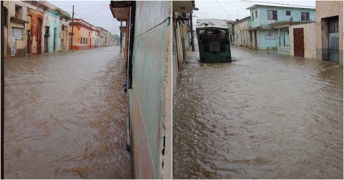
Images circulating depict the devastation in San Antonio de los Baños, another area extensively battered by the downpour. Although local authorities have yet to report on material damages or impacts on residents, the situation highlights the fragile infrastructure in regions where any intense rainfall poses a threat to homes, streets, and essential services.
Continuing Weather Threats
Ruisanchez noted in another social media post that more rain is anticipated on Saturday afternoon, particularly in the western and central regions, where strong intensities are expected, especially in the interior and along the north coast of the west.
An expansive low-pressure area is situated in the eastern Gulf of Mexico, creating a southward moist flow. A trough is also present over the southeastern Gulf and western Cuba at mid and upper troposphere levels. This scenario maintains high relative humidity levels, which, combined with daytime heating, enhances the likelihood of showers, rain, and thunderstorms, particularly in the afternoon, Ruisanchez explained.
Infrastructure Risks and Public Safety
He advised avoiding flooded areas, staying clear of thunderstorms, and keeping abreast of local weather alerts. Cuba's streets and highways are fraught with dangers, exacerbated by rain and resulting floods, as evidenced by reports of uncovered drains and neglected waterways.
In Bayamo city, Granma province, heavy showers on Wednesday led to widespread street flooding and disrupted traffic, affecting the local population. Even a light drizzle was enough to flood several streets in Havana at the end of August, further highlighting the collapse of the sewer system, as residents of the Cuban capital have pointed out.
Recently, flooding was also reported on Calzada del Cerro, where videos shared by independent media outlet CubaNet showed the iconic avenue transformed into a river, with water reaching the doorsteps of homes. Urban flooding has become a regular occurrence for Havanans. Weeks ago, heavy rains caused street and home collapses in several neighborhoods, with a tragic building collapse in Cerro resulting in the death of a five-month-old infant.
Frequently Asked Questions About Weather Impact in Cuba
What areas in Artemisa were most affected by recent heavy rains?
San Antonio de los Baños and Mariel were among the most affected areas in Artemisa due to the recent heavy rains.
How much rainfall was recorded in Mariel?
The automatic weather station in Mariel recorded 41.1 millimeters of rain in just a few hours.
What are the current weather conditions contributing to the rainfall?
A low-pressure area in the eastern Gulf of Mexico and a trough over the southeastern Gulf and western Cuba are creating a moist southward flow, enhancing rainfall likelihood.
What precautions are recommended during heavy rain in Cuba?
It is advised to avoid flooded areas, stay away from thunderstorms, and keep updated on local weather alerts.