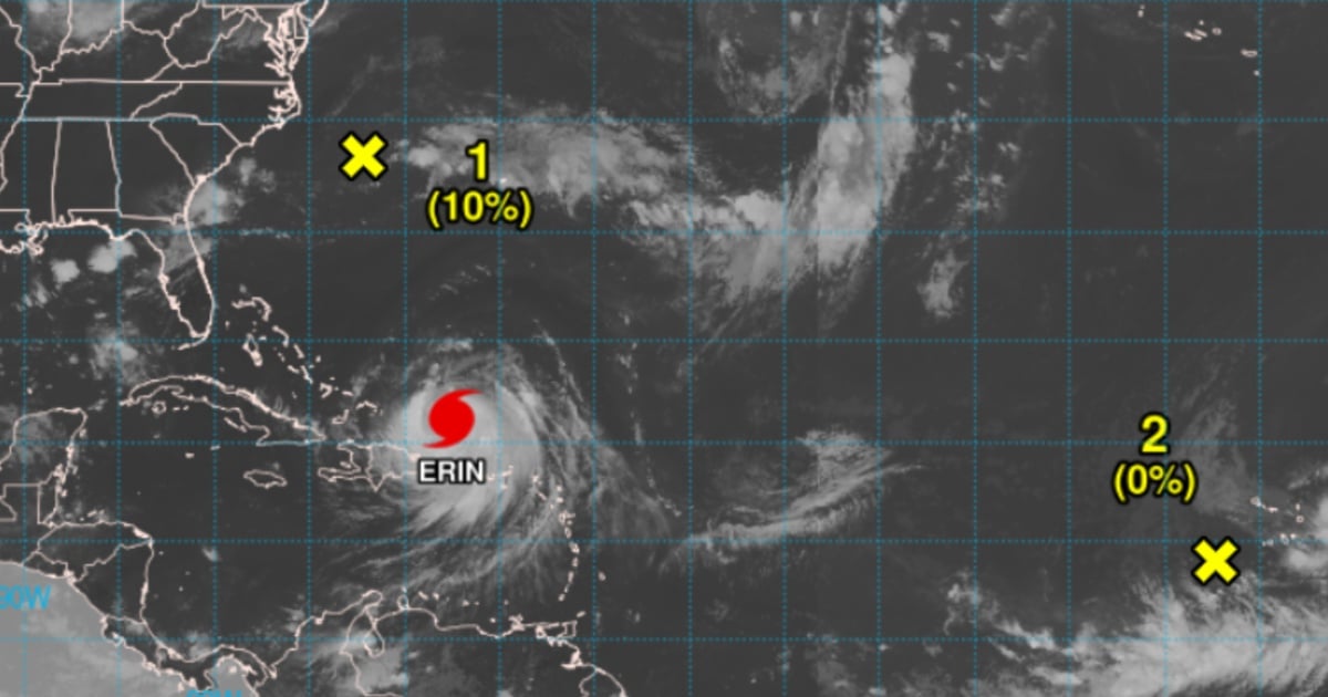
Hurricane Erin, the first major storm of the 2025 Atlantic hurricane season, has weakened to a Category 3 as it moves over the Atlantic Ocean, north of the Caribbean. Just a day prior, it had reached the intensity of a Category 5 storm. According to the National Hurricane Center (NHC) in the United States, Erin is currently producing maximum sustained winds of 124 mph. Its center was positioned roughly 170 miles north of San Juan, Puerto Rico, and 270 miles east of Grand Turk Island, moving in a west-northwest direction at approximately 14 mph.
Experts caution that despite its downgrade, Erin remains a powerful and dangerous hurricane. The storm may experience intensity fluctuations in the coming days due to an eyewall replacement cycle. This process can momentarily weaken the storm but might also allow it to regain strength later on.
A tropical storm warning is in effect for the Turks and Caicos Islands. Meanwhile, significant rainfalls are being reported in Puerto Rico and the Virgin Islands, with accumulations ranging from 3 to 6 inches, and isolated areas receiving up to 8 inches. Additionally, swells and strong rip currents are expected to affect the southeastern coast of the United States by midweek.
While neither the Cuban mainland nor the continental United States is forecasted to face a direct hit, meteorological authorities advise caution. The expanding size of the storm heightens the risk of coastal flooding and wave action.
In addition to Erin, meteorologists are closely monitoring a tropical wave situated in the central tropical Atlantic. Currently located near the Cape Verde Islands, this system is producing scattered showers and thunderstorms. It is anticipated that the system might gradually develop as it moves to the west-northwest at a speed of 9 to 12 mph across the eastern and central tropical Atlantic. The likelihood of formation remains low, with a 0% chance in the next 48 hours and a 20% chance over the next seven days.
For the 2025 hurricane season, Cuba faces a 50% chance of being impacted by a hurricane, a notable increase from the usual climatological threat level of 35%. The likelihood of a tropical storm affecting the island is even higher, at 70%. Warmer-than-average sea surface temperatures in the Atlantic and Caribbean are significant factors contributing to a more active hurricane season. Additionally, a neutral ENSO (El Niño-Southern Oscillation) phase and a more vigorous West African monsoon are enhancing cyclone formation and strengthening in the region.
Understanding the 2025 Atlantic Hurricane Season
What is the current status of Hurricane Erin?
Hurricane Erin has been downgraded to a Category 3 storm with maximum sustained winds of 124 mph. Despite its weakened state, it remains a significant threat, with potential intensity fluctuations expected.
Is there a risk of Hurricane Erin impacting the United States or Cuba directly?
Currently, no direct impact on the continental United States or Cuba is anticipated. However, the storm's increasing size could lead to coastal flooding and strong waves along affected coastlines.
What factors are contributing to an active hurricane season in 2025?
The 2025 hurricane season is being influenced by warmer-than-average sea surface temperatures in the Atlantic and Caribbean, a neutral ENSO phase, and a stronger West African monsoon, all of which are conducive to cyclone development and intensification.