Tropical Storm Erin has picked up a bit of speed recently, yet it continues to sustain wind speeds of 45 mph (75 km/h), with even stronger gusts. Currently moving westward at approximately 19 mph (31 km/h), Erin is expected to maintain this trajectory until Thursday. Following this, the storm is anticipated to gradually veer to the west-northwest starting Thursday night and continuing through the weekend.
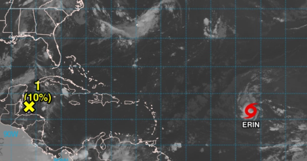
The National Hurricane Center (NHC) forecasts a gradual intensification starting Wednesday, with a significant chance of Erin escalating to hurricane status between Thursday afternoon and early Friday morning. According to advisory number 8, released at 5:00 a.m. AST by the NHC, Erin was positioned at latitude 16.5°N and longitude 41.9°W, roughly 1,400 miles (2,255 kilometers) east of the Northern Leeward Islands.
Forecast and Preparations
Forecast models suggest that if Erin maintains its current path, its center will pass near or just north of the Northern Leeward Islands over the weekend. Although no coastal warnings or alerts have been issued yet, the NHC advises residents and officials in the Northern Leeward Islands, the Virgin Islands, and Puerto Rico to monitor the storm’s progress closely.
Erin currently has a minimum central pressure estimated at 1004 millibars. The tropical storm-force winds extend up to 60 miles (95 kilometers) from the storm's center.
Potential Impacts
While it’s too early to determine direct impacts on populated areas, the NHC warns that swells generated by Erin could begin affecting the Northern Leeward Islands, the Virgin Islands, and Puerto Rico over the weekend. These waves might produce dangerous rip currents and rough sea conditions, prompting coastal residents and mariners to stay updated with local bulletins and adhere to civil protection advice.
The NHC stresses the importance of continuous monitoring of Erin, as its projected path and intensity could change over the next 48 to 72 hours.
Erin marks the fifth tropical storm in the current hurricane season. Previous storms Andrea, Barry, Chantal, and Dexter failed to reach hurricane strength, dissipating before they could fully develop. The Atlantic hurricane season officially began on June 1 and will continue until November 30.
Weather experts had previously cautioned that the year 2025 might be characterized by the formation of more intense and frequent cyclones.
Frequently Asked Questions about Tropical Storm Erin
What is the current intensity of Tropical Storm Erin?
As of the latest advisory, Erin's wind speeds are sustained at 45 mph (75 km/h) with stronger gusts.
Where is Tropical Storm Erin currently located?
Erin is currently positioned at a latitude of 16.5°N and a longitude of 41.9°W, about 1,400 miles east of the Northern Leeward Islands.
When is Erin expected to become a hurricane?
The NHC predicts that Erin may reach hurricane strength between Thursday afternoon and early Friday morning.
Are there any alerts for the Northern Leeward Islands?
Currently, there are no coastal alerts or warnings, but residents are advised to monitor Erin's development closely.