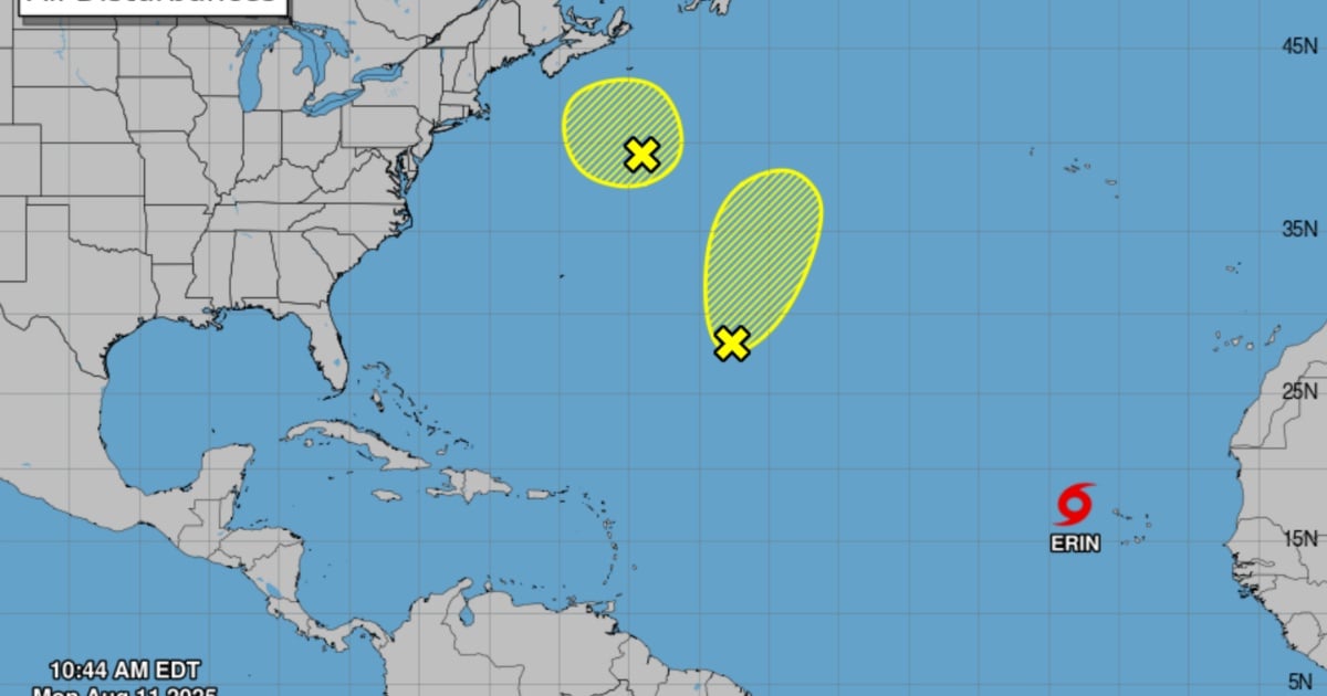
The Cuban Institute of Meteorology (INSMET) issued its first tropical storm alert on Monday following the formation of Tropical Storm Erin in the eastern Atlantic. Erin is the fifth tropical storm of the season, featuring maximum sustained winds of 75 kilometers per hour with higher gusts and a central pressure of 1004 hectopascals. It is currently moving west at 31 kilometers per hour, according to INSMET.
As of 11 a.m. today, Erin was located at 17.4 degrees North latitude and 28.0 degrees West longitude, positioning it 455 kilometers west-northwest of the Cape Verde Islands and 3,710 kilometers east of the northern group of the Lesser Antilles. INSMET forecasts that Erin will continue on a similar course and speed, gradually gaining organization and intensity as it travels over the open waters of the eastern Atlantic Ocean.
Currently, Erin poses no threat to Cuba, as confirmed by meteorologists. However, due to its position and the time of year, the Forecast Center is closely monitoring the system's development. The next tropical cyclone advisory is scheduled for 6 p.m. on Monday.
The U.S. National Hurricane Center (NHC) also reported Erin's formation on Monday and is monitoring other systems in the Atlantic. One is a weak trough over the central Atlantic with only a 10% chance of development within the next seven days. The other is a non-tropical system located in the northwest Atlantic, south-southeast of Nova Scotia, with a low potential for becoming a cyclone before moving over cooler waters.
The Atlantic hurricane season runs through November 30, with August marking the start of its peak activity period. Recently, the Cuban Meteorology Institute announced that the 2025 Atlantic North hurricane season is expected to be active, predicting the formation of 11 tropical storms for the remainder of the period, with seven potentially reaching hurricane status.
The forecast, updated on August 4, highlights a high likelihood of impacts in the Caribbean and Cuba. According to the meteorological report, seven of the storms will develop in the Atlantic, one in the Gulf of Mexico, and three in the Caribbean Sea. There is an 85% chance of at least one hurricane originating in the Caribbean, and a 70% risk that an Atlantic-origin hurricane could enter this region.
Frequently Asked Questions about Tropical Storm Erin and the Atlantic Hurricane Season
What is the current status of Tropical Storm Erin?
As of the latest update, Tropical Storm Erin is located in the eastern Atlantic and is moving west. It is gradually gaining strength but poses no immediate threat to Cuba.
How active is the 2025 Atlantic hurricane season expected to be?
The 2025 Atlantic hurricane season is anticipated to be quite active, with predictions of 11 tropical storms forming, seven of which could become hurricanes.
What are the chances of a hurricane impacting the Caribbean this season?
There is an 85% probability of at least one hurricane originating in the Caribbean, and a 70% chance that an Atlantic-origin hurricane could impact the region.